Home » Mexico Travel Info » Mexico Driving » Baja Map
Baja California Map
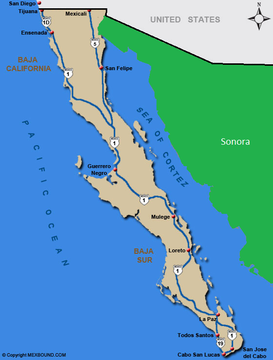
The Map of Baja California shows the driving route to Cabo San Lucas. The trip to Cabo San Lucas is over 1000 miles and will take you approximately 24 hours to get there from the San Diego International Border. If you do decide to take the over 1000 mile drive to Cabo San Lucas, make sure you get Mexican Insurance and check out our driving and safety tips or visit our Baja driving distances section. The map of Baja below shows highways and cities in Baja. Click on the cities below to see driving maps and directions to various cities in Baja California.
Baja Maps and Driving Directions

The maps and directions provided in this section are opinionated general guidelines for driving in Mexico. We offer these Mexico maps and directions, to show possible driving routes to various cities in Mexico. Highways and road conditions are constantly changing, be sure to consult a Mexico road map for official driving routes in Mexico.